I. Intro
Date: 11/07/2022
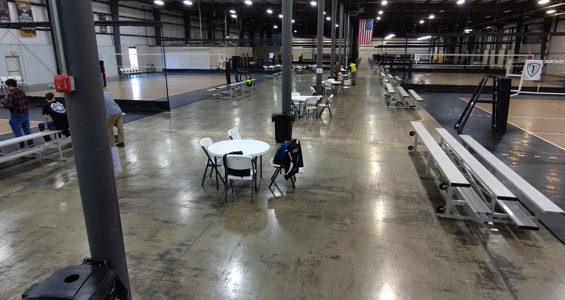
We used Skydio 2+ Enterprise to operate a mission in a building at the Boiler Junior Volleyball Center.
II. Field Condition
1. Site Condition
The flying site is at Boiler Juniors Volleyball Center. It’s a large building with a lot of nets that were invisible to Skydio.
2. Weather Condition
- Temperature: 14℃
- Wind: 9.3 km/h, SSW
- Cloud: 0%

3. Safety Assessment
1. There were wires less than 0.5 inches in diameter, and the drone can’t see them.
2. There were a lot of nets around the court, and the drone can’t see them.
3. There were branches around the parking lot, and the drone can’t see them.
III. Operation
1. Preparation
The case was placed on the floor, and the Skydio 2+ was placed on the case. After we format the SD card, Skydio 2+ took off. We set the boundaries of the flight area and started the mission.
2. Flight Details
(1). General Information
- Location: Boiler Juniors Volleyball Center
- Vehicle: Skydio 2+ Enterprise
- Sensor: Sony IMX577
- Battery: Skydio 2+ Enterprise Battery
- Approval # (LAANC/COA/Waiver): NA (below 400 ft AGL in class G)
(2). Flight Information
- Flight Number: 5, Pole scan, Cable, Hover, Key frame, and Fixed track
- Takeoff Time: Flight 1: 15:02 Flight 2: 15:24 Flight 3: 15:36 Flight 4:15:49 Flight 5: 16:06
- Landing Time: Flight 1: 15:06 Flight 2: 15:36 Flight 3: 15:37 Flight 4: 16:05 Flight 5: 16:12
- Altitude (m): <15
- Sensor Angle: NA (changing)
- Overlap: 80%
- Sidelap: 80%
- PIC and VO: Dingming Lu, Caleb Gascho, Harrison Guinn
3. Flight Operation
Flight 1: Pole Scan:
When setting the pillars, the camera should face up so it can scan everything above it. It only took 15 pictures. During the first flight, we didn’t let the camera face up. During the second flight, the system suddenly reported dirty camera lenses when we were setting the pillars. PIC: Dingming Lu, VO: Caleb Gascho, Harrison Guinn

Flight 2: Cable
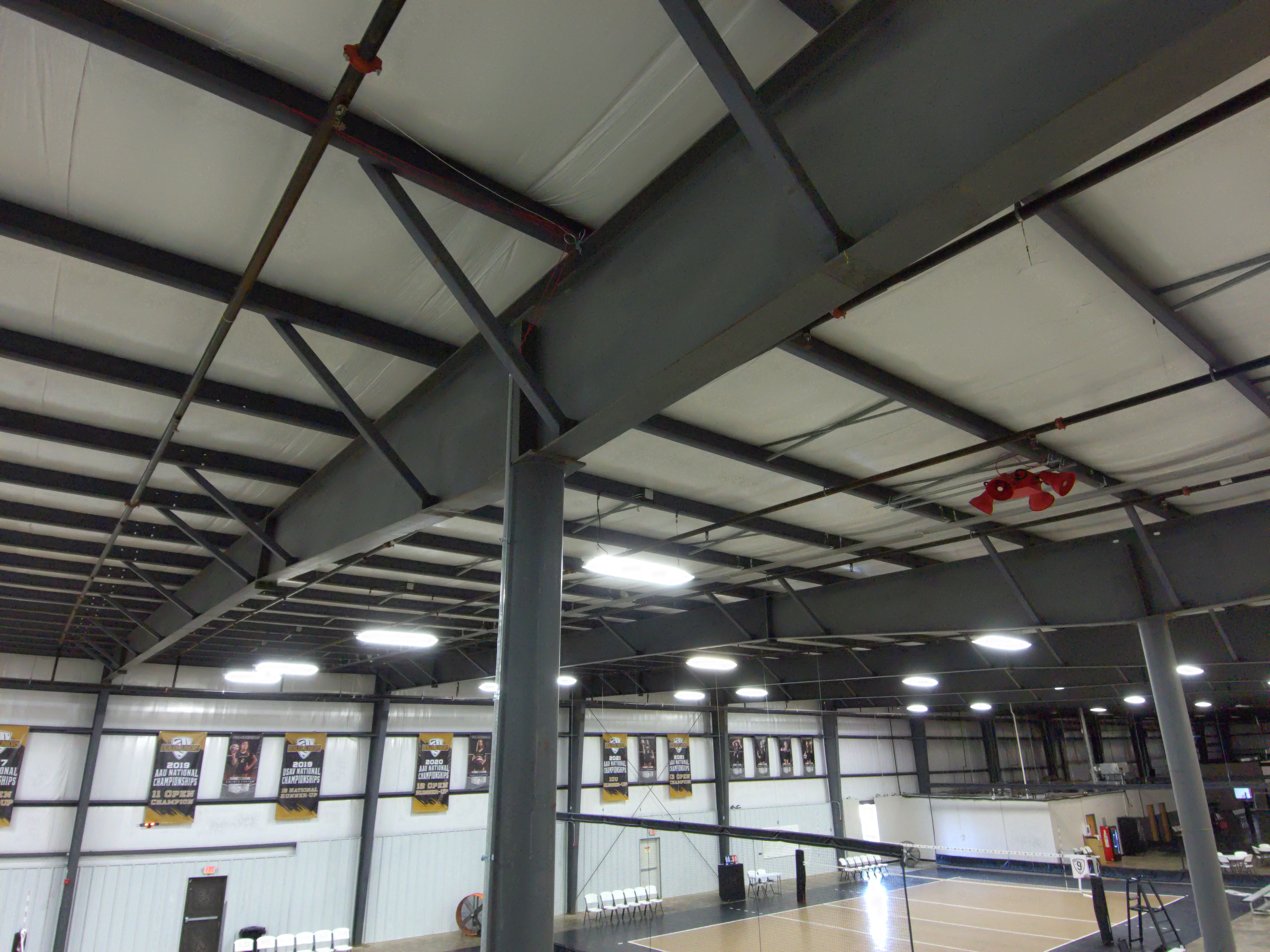
after it took off, we adjusted the camera at a 45 degree angle to the right to capture the banners and set point A. At the other side of the building, we set point B. When flying from B to A, the drone left the course and we have to pause the mission because it couldn’t see the net and it’s going to hit it. We adjust the position manually and resume the mission to A. When flying from A to B, the drone couldn’t stay the same altitude. It could just fly under and through the flag, but it detected the flag and raise the altitude to avoid the flag. We had to pause the mission, lower the altitude, passed the flag, and resume the mission. On the way back from B to A, we just flew it fully manually. PIC: Caleb Gascho, VO: Dingming Lu, Harrison Guinn.
Flight 3: Hover
We hover the Skydio in the air, and landed. It took less than 1 minute.
Flight 4: Key Frame:
It took off and flew to a sign on the door outside, set a point, and then we adjust the position to the second keyframe. It worked as expected. Then we tried to add more keyframes to capture more part of the building, but somehow the app quit the key frame function, and all the keyframes were gone. PIC: Harrison Guinn, VO: Dingming Lu, Caleb Gascho.
Flight 5: Fixed Track
After we select the object to track, we tried to adjust the position of the drone, but it didn’t move enough distant as we expected, and sometimes it moved very violently that we thought it might hit the tree branches. So we gave up to make changes and just kept the angle we have initially. PIC: Dingming Lu, VO: Caleb Gascho, Harrison Guinn.